Terrain add-ons

See the shape of your land.

Contours, slope classes and how many hectares of each paddock sit on each slope. It’s built from the national LiDAR elevation model and matched to the paddocks on your farm map.

Contours, slope classes and an area-by-slope schedule for a course or site we have mapped. In New Zealand it’s built from the national LiDAR elevation model and matched to your course map.
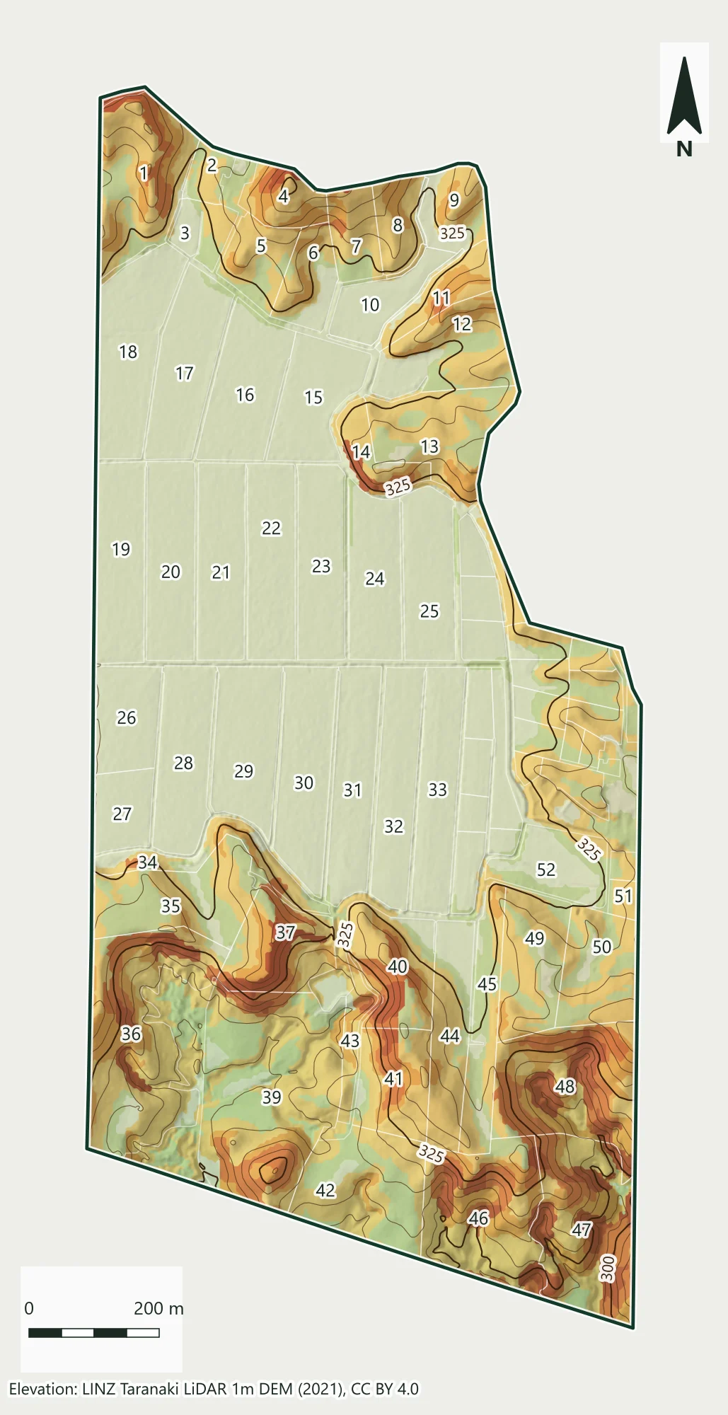
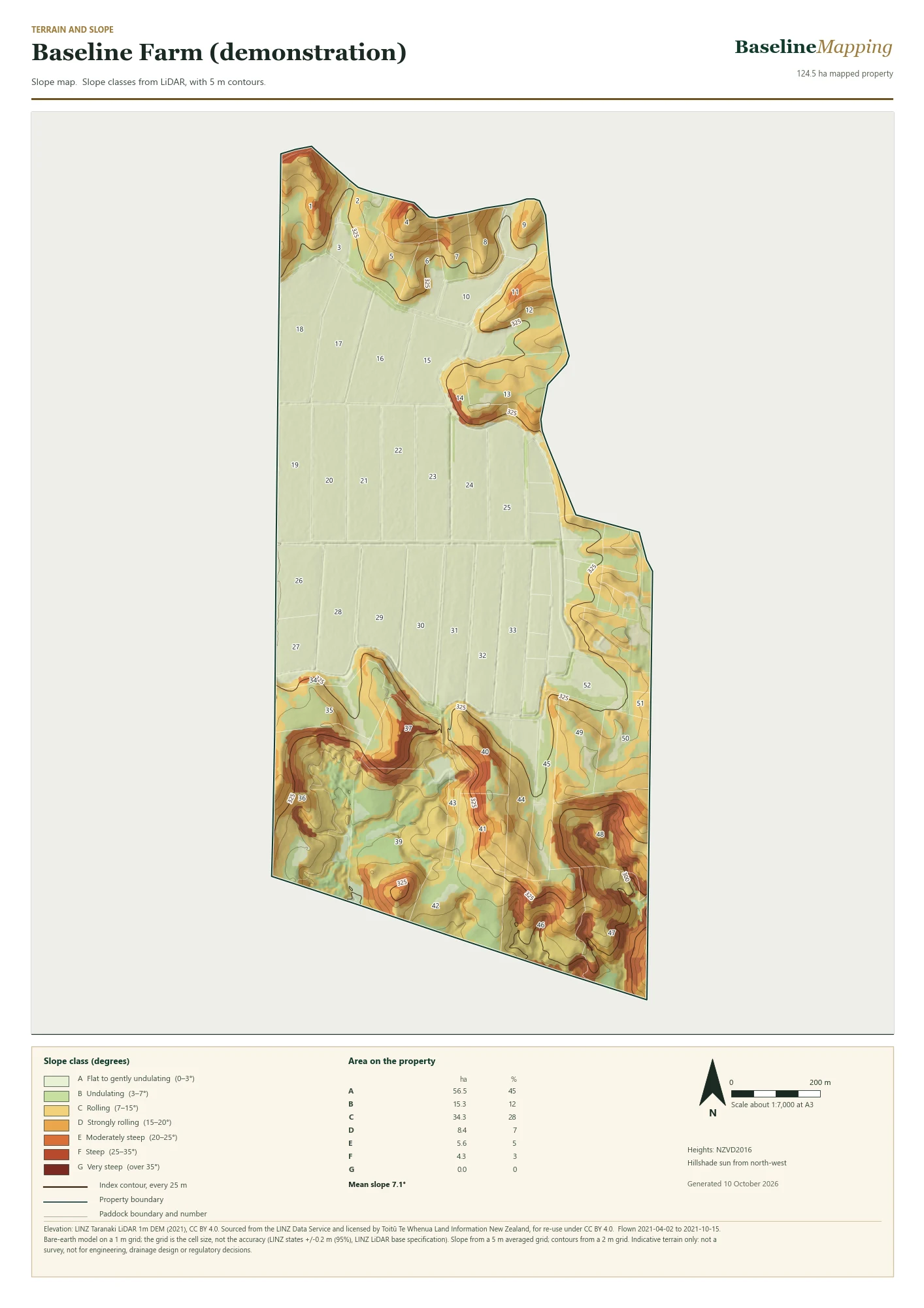
Slope map of Baseline Farm, a demonstration property: paddocks coloured by slope class from pale green on the flat to dark red on the steepest faces, with labelled 25 metre index contours and paddock numbers.
Baseline Farm (demonstration): the slope map from the terrain bundle, built from LiDAR. Paddock numbers and contours are drawn over the slope classes. Open the full A3 sheet as an image. Elevation: LINZ Taranaki LiDAR 1m DEM (2021), CC BY 4.0. Sourced from the LINZ Data Service and licensed by Toitū Te Whenua Land Information New Zealand, for re-use under CC BY 4.0.

What the colours mean

Slope classes you can plan with.

Slope is grouped into the NZ Land Use Capability slope classes, from flat to very steep. With the terrain bundle, every paddock gets its hectares in each class, so you can see how much of it is easy country and how much isn’t.

Slope is grouped into the NZ Land Use Capability slope classes, from flat to very steep. With the terrain bundle, every mapped area of the course or site gets its hectares in each class, so you can see how much of it is flat and how much is steep.

  • A Flat to gently undulating (0–3°)
  • B Undulating (3–7°)
  • C Rolling (7–15°)
  • D Strongly rolling (15–20°)
  • E Moderately steep (20–25°)
  • F Steep (25–35°)
  • G Very steep (over 35°)

Contours: 5 m interval with labelled 25 m index lines on farm sheets. Heights are NZVD2016.

Contours: 5 m interval with labelled 25 m index lines on the terrain sheet. Heights are NZVD2016.

Contours

Contours you can read on the ground.

Every 5 metres of height gets a line, and every 25 metres gets a heavier, labelled index line, drawn over shaded relief tinted from low ground to high. Tight lines are steep country; wide gaps are flat. The same lines come as data you can open in QGIS or ArcGIS.

This close-up is Baseline Farm, a demonstration property. Heights are NZVD2016.
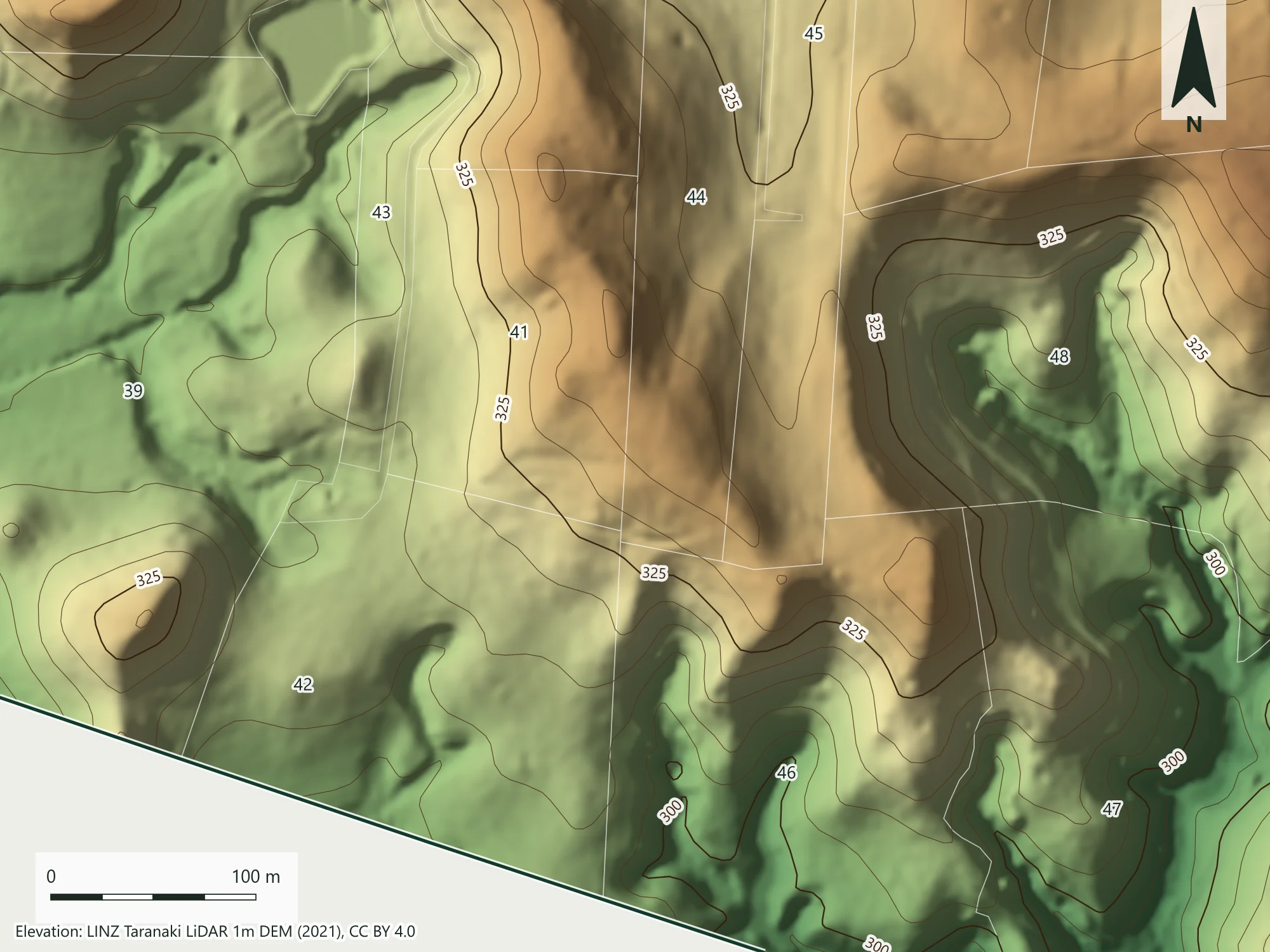
Close-up contour map of part of Baseline Farm, a demonstration property: 5 metre contours with labelled 25 metre index contours over shaded relief tinted from green on low ground to brown on high ground, with paddock numbers.
Baseline Farm (demonstration): a close-up of the contour map. Elevation: LINZ Taranaki LiDAR 1m DEM (2021), CC BY 4.0. Sourced from the LINZ Data Service and licensed by Toitū Te Whenua Land Information New Zealand, for re-use under CC BY 4.0.

Two options

Choose what you need.

Both are added to a farm we map. Order them with a new farm map, from $750 for Baseline, or add them later to a farm we have already mapped.

Both are added to a course or site we map. Ask for them with a new Course Map, or add them later to a course we have already mapped.

Elevation and contours

$250one-off · NZD, excluding GST

  • Existing mapped site
  • Terrain PDF and contour data
  • Source suitability assessment required
Ask about Elevation and contours

Terrain analysis bundle

$450one-off · NZD, excluding GST

  • Elevation and contours
  • Slope map and area schedule
  • Existing mapped site; suitable terrain source required
Ask about Terrain analysis bundle
See the farm mapping packages See the golf and turf packages

What you receive

The sheet, the data and where it came from.

  • An A3 terrain sheet: hillshade, contours and your farm boundary
  • An A3 terrain sheet: hillshade, contours and your course or site boundary
  • Contour lines as mapped data you can open in QGIS, ArcGIS and most mapping software
  • With the bundle: a slope class map and an area-by-slope spreadsheet for every paddock
  • With the bundle: a slope class map and an area-by-slope spreadsheet for every mapped area
  • A source note naming the LiDAR survey, when it was flown, the height datum and its stated accuracy

Checked before you pay

Not every property has the data.

We check LiDAR coverage for your boundary first. If the national 1m model covers less than 95% of your property, we don’t offer terrain for it, and we tell you before you pay rather than hand you a map with holes in it.

These products currently use LINZ data, so they’re available for New Zealand properties. Mapping somewhere else? Ask us and we’ll see what reliable data exists.

Honest about the limits.

  • A 1 m grid is not 1 m accuracy: the grid is the cell size, not the survey accuracy. The LINZ LiDAR specification states ±0.2 m vertical (95%), and the source note for your property quotes the accuracy stated for the survey behind it.
  • It’s a bare-earth model. Trees, buildings, and earthworks or slips since the survey aren’t shown.
  • It supports farm planning. It is not a survey, and it is not for engineering, drainage design or regulatory decisions without professional advice.
  • It supports course and site planning. It is not a survey, and it is not for engineering, drainage design or regulatory decisions without professional advice.
  • Terrain sheets show the survey date, so you always know how current the picture is.

Source: LINZ Data Service, New Zealand LiDAR 1m DEM, licensed by Toitū Te Whenua Land Information New Zealand for re-use under CC BY 4.0. LINZ can add or replace surveys, so coverage and survey dates can change. Last checked 10 October 2026.

All prices NZD, excluding GST. Standard orders are paid fully upfront after scope and data coverage are confirmed.