What do the irrigation and drainage layers on a course map show?
They show the irrigation and drainage records your club supplies, drawn onto the course map as supplied. They are not located on site, so they do not show where buried pipes, cables or drains actually are, or whether it is safe to dig. They are for planning, briefing staff and keeping the records in one place, read against the course.
Facts checked 18 October 2026
Where the lines come from
We map a course remotely, from aerial imagery. Imagery shows what is on the surface: it cannot show a buried pipe, a drain, a valve box under turf or a cable. So the irrigation and drainage on a Course Map come from your records: irrigation plans, as-built drawings, a contractor’s drainage plan, or a sketch someone made after the last repair.
We bring those records onto the course map and draw them as they are, on operational sheets for the greens staff.
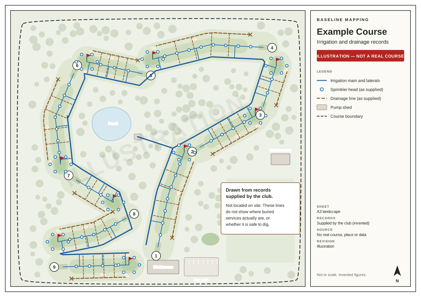
The example above is an illustration of a fictional course, with invented records.
What “as supplied” means
- We rely on your records as given. We do not check them independently unless your order says we will, though we tell you if something looks wrong to us.
- If a record is out of date, the line on the map is out of date too. A main moved in a renovation stays where the old plan put it until you tell us.
- If two of your records disagree, tell us which one to draw. If we notice a conflict you have not mentioned, we tell you.
- You need the right to pass the records on. If a contractor or designer made them, check you are free to share them.
What the layers are not
A line on the map shows the record it was drawn from. It does not show where the pipe or drain actually is in the ground, how deep it is, or whether it is safe to dig. The layers are not a located survey of services, and they are not a basis for engineering or drainage design. Clause 4 of our terms of trade says so in full.
Before anyone digs
Treat the map as a guide to which records to look at, not as the answer. Before digging, have the services located on site by someone qualified to do it. In New Zealand, beforeUdig takes requests for the plans of underground utility networks; the club’s own irrigation and drainage are private, so ask whoever installed or maintains them as well.
Why bring them onto the map at all
- One place. The records stop living in a drawer, a laptop and someone’s memory.
- Read against the course. A drainage plan drawn on the hole it serves is easier to follow than a drawing with no course on it.
- Planning. Where a renovation, a new tee or a tree removal sits against the records, before anyone quotes.
- Handover. A new course manager or contractor gets the records and the course on one sheet.
Keeping them current
When a line is repaired, moved or added, send the new as-built. Within six months of your first draft a correction within the agreed scope is a revision; after that, see keeping a course map current.
Sources
Want this for your course?
Published prices by hole count. Tell us about the course and we’ll confirm the scope before you pay.