How do you read a golf course hole sheet?
A hole sheet shows one hole on its own: the tee, fairway, bunkers, green and rough drawn and labelled, with a table of that hole's surface areas. Around the map, the sheet says which course and hole it is, the imagery date, the revision date and where the data came from. The course overview shows every hole together; the hole sheets are the close-ups you hand to staff or a contractor working on one hole.
Facts checked 18 October 2026
What is on a hole sheet
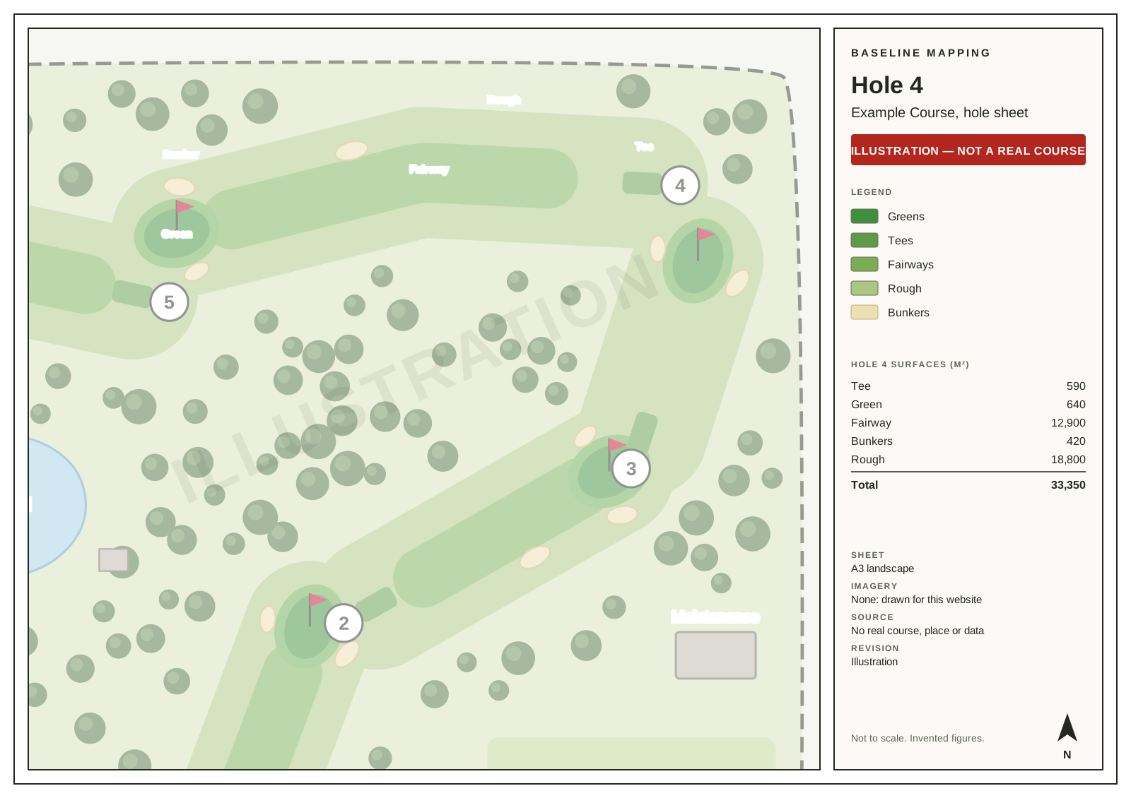
The example above is an illustration of a fictional course, not a real one.
The map. One hole, with each surface drawn and labelled: the tee, the fairway (a short hole may have none), the bunkers, the green and the rough. Enough of the course around it shows to see where the hole sits.
The area table. The area of each surface on that hole, in square metres, and the hole’s total. The same figures are in the surface area spreadsheet, hole by hole.
The sheet furniture. The course and the hole, a legend, a scale bar, a north arrow, the coordinate system, the dates and sources below, and a short note on what the map is not for.
The dates on the sheet
Each sheet states two dates. The imagery date is when the aerial photos the map was drawn from were taken. The revision date is when this version of the sheet was drawn. When we correct a map, you get a new dated version, so if two copies of a hole sheet disagree, the later revision date is the current one.
The imagery date matters because a course changes. A tee built, a bunker grassed over or a green reshaped since the photos were taken will not be on the first draft until you tell us. That is what the review and the six months of revisions are for.
Where the data came from
The sheet names its sources and carries their credit. For a course in New Zealand, the aerial imagery comes from Toitū Te Whenua Land Information New Zealand (LINZ), published under CC BY 4.0, which asks that the credit stays with the map. Elsewhere we use the local sources we identify for your job.
What the areas mean
- They are measured on the flat map. On a steep bank or a raised green the ground itself is a little larger than its mapped area.
- They are approximate. They depend on the imagery and on the corrections you give us, and we do not promise a tolerance unless your order states one.
- Each piece of ground is in one surface only, so a hole’s surfaces add up to its total.
Using hole sheets day to day
- Briefing staff. Print the sheet for the hole being worked on, and mark the job on it.
- Contractors. A hole sheet shows exactly which surface, on which hole, a quote or a job is for.
- Committee papers. A renovation proposal for one hole reads better with its sheet and its areas beside it.
- Checking the map. Hole by hole is the easiest way to review the draft: go round the course with the sheets and circle what is wrong.
What a hole sheet is not
It is a map for managing the course, made remotely from imagery and records. It is not a legal survey, an engineering survey or a certified plan, and it does not replace agronomy advice. Clause 4 of our terms of trade has the full wording. If you need a plan for design or construction work, ask the professional doing that work what they need; if a course map would help them, we can tell you whether it suits.
Questions about a sheet you already have? Ring 022 693 9101 or email office@baselinemapping.co.nz.
Sources
- Toitū Te Whenua LINZ, New Zealand imagery catalogue (nz-imagery): the public aerial photos a New Zealand course is mapped from
- Creative Commons, Attribution 4.0 International (CC BY 4.0): the licence LINZ imagery is published under, and why sheets carry its credit
- Baseline Mapping, terms of trade: clause 4 (what maps are for) and clause 10 (imagery dates and attribution)
Want this for your course?
Published prices by hole count. Tell us about the course and we’ll confirm the scope before you pay.